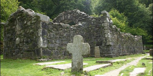
The remains of Reefert Church are situated in a woodland setting, on the south-eastern shore of the Upper Lake close to the Information Office. Reefert derives its name from the Irish ‘Righ Fearta’ meaning burial place of the kings (referring to the local rulers – the O’Toole family). It dates from the eleventh century and is likely to have been built on the site of an earlier church. The church and graveyard were originally surrounded by a stone wall enclosure known in Gaelic as a ‘caiseal’. Most of the present surrounding walls however are modern. The upper parts of the church walls were re-built over 100 years ago using the original stones.
GPS Coordinates
Latitude: 52.981331
Longitude: -6.042031
